Appalachian Trail Sections
N.C./GA ·
TENN/N.C. ·
S.W. VA ·
CENTRAL VA ·
SHENANDOAH ·
WV/N.VA · MD/PA · NJ · NY · CT · MA · VT · NH · ME
WV/N.VA · MD/PA · NJ · NY · CT · MA · VT · NH · ME
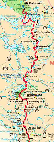
MAINE
N.C./GA ·
TENN/N.C. ·
S.W. VA ·
CENTRAL VA ·
SHENANDOAH ·
WV/N.VA · MD/PA · NJ · NY · CT · MA · VT · NH · ME
WV/N.VA · MD/PA · NJ · NY · CT · MA · VT · NH · ME
[Top ^]
* * *