|
Page Contents
Related Trips NPS Data Pages Delaware Water Gap Natl Recreation Area Maps/River Sections Full Park Map (470k) Other Resources
|
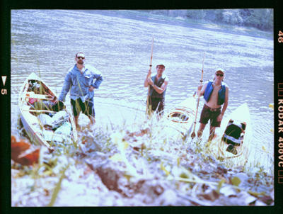
I paddled my trusty, homebuilt Cape Charles 18 touring kayak.
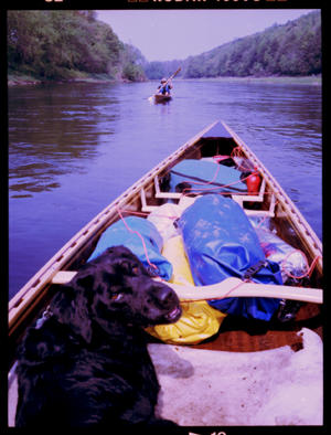
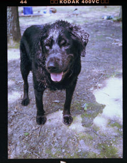
Chris and (and his pooch Otis) rode in Chris's homebuilt Freedom 17 woodstrip canoe.
Magnus paddled Chris's lately underutilized open cockpit Pocomoke 1.5 man kayak.
The Delaware Water Gap Nat'l Recreation Area preserves a little over 40 miles of the Middle Delaware River running along the Pennsylvania/New Jersey Border immediately south of NY State
The Recreation Area is blessed with numerous primitive backcountry campsites (officially reserved for long distance paddlers) on the PA and NJ shores as well as the islands that dot the channel of the Middle Delaware.
Based on our experience the previous season we arranged to cut out the first 8 odd miles and the last 7 or 8 miles of the park above the Water Gap making for a somewhat leisurely 3 1/2 day 25 mile paddle
Day 1: Bushkill Access To Minisink Island
Nothing goes as planned. And, following repeated set backs, Chris ended up meeting me at the takeout, Smithfield Beach, about 2 hours behind schedule to drop his truck.
In addition, we were both a little scr*wed by the brand spanking new automated NPS parking fee collection system (only 1 and 5 dollar bills accepted for the time being) At least it was a stellar day and a nice place to wait.
Unfortunately, we didn't get to Bushkill until almost 5 p.m. and I really had to hustle to unload and pack my kayak.
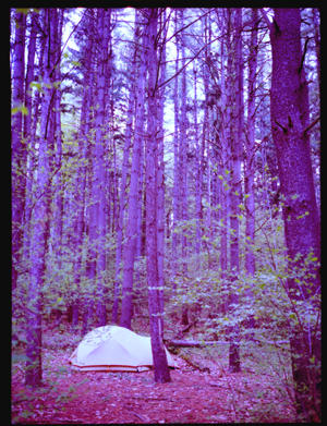
Fortunately it was a short quick paddle to our first site at Minisink Island, and we managed to make camp, light a fire and set to grilling steaks before the sun completely set (note to Chris: remember the salt next time).
Day 2: Minisink Island To Hornbeck Campsites
Lazy eight mile paddle to Hornbeck Campsites. I paddled hard for the first 4 odd miles to the toll bridge at Dinhgman's Ferry -- kinda cool suspended structure but a little unnerving to sit under -- the open slats shake violently when a car passes over.
Unfortunately the Cape Charles runs much faster than the Pocomoke and Freedom (particularly since Chris had 70% of the gear and water) and I lost contact with the others pretty quickly (turns out Magnus had dropped his talkabout overboard about 20 minutes into the paddle) and was waiting at Dinghman's for what seemed like forever.
We watered up at the Dinghman's Access and had to run the pump a bit to clear out rust and minerals that accumulated from under use during the winter, but there is generally decent hand pumped water at the NPS Access points about every 5-10 miles or so on the river
The river is running a hair higher this season, probably because we are out about two weeks earlier this year. At any rate there are many fewer fatal skiffles this year and it makes the paddling a hair faster and hair more pleasant.
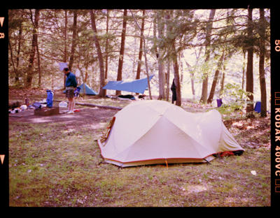
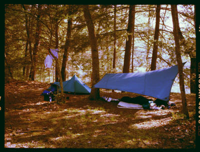
We found a nice site at Hornbeck another 4 miles on with two a levels: a bench about fifteen feet above the river and larger plateau another twenty feet up.
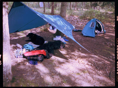
The lower bench had a nice view of the river. That's where I pitched my Solitude and set up my Stingray tarp as a group kitchen.
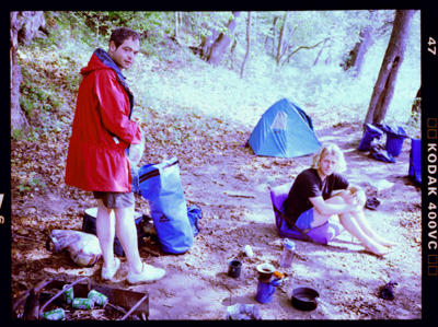
Chris and Magnus pitched up above. It looked like it might rain.
Over dinner Magnus told us that when he served in the Swedish Army he worked in a radar bunker and carried a machine gun. He told us they carried non-lethal, wooden amunition in the guns and that once he got in trouble for shooting over the heads of some local kids who were harrassing them on march.
Otherwise he seems pretty laid back.
Day 3: Hornbeck Campsites To Freeman Point
Woke up dry after a night of light rain.
Spent a lazy morning laying around camp and set out about a little after ten a.m. for Freeman Point at the foot of the Walpack Bend about 15 miles on.
A stellar and near windless day. Made camp around 3 p.m.
Awesome campsite on top of an unfortunately steep ledge. (Chris had read about it in guide book) Actually two camp sites but the upper site which is in a big clearing with an awesome view of the river is worth the extra climb. Chris's new solo Moss tore so he is sleeping under my Stingray tarp tonight. Curious to see how that works out.
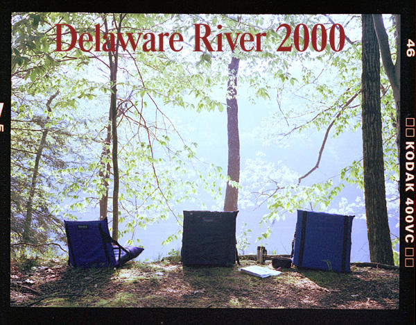
Set our trail chairs on the edge of the ledge and had dinner 40' over the river. Nice.
Day 4: Freeman Point To Smithfield Beach
Very sunny but windy day. Short sweet paddle out for me. Nice ride down the Sambo Rift (best part of the river when the water is high)
Chris had a bit more trouble with the wind and was hair tetchy by the time he pulled into Smithfield. Decently early in the day when we landed, but as usual we ate up a lot of time shuttling cars and need to plan that better.
This was my second trip with the Solidtude which packs nice and tight (i.e. is kayak hatch friendly) and it did keep me nice and dry although I do find it a hair small.
Chris liked sleeping the Stingray open air and I will have to try that.
Over all another awesome few days in the near wilderness.
Curious Little Gallery
|
[Top ^]